


Arctic Climate & Weather: How Cold Is The Arctic Really?

One word that comes to many people’s mind when they think of the Arctic? Cold. But just how cold is the Arctic? Is it the most all-out frigid place on Earth?
In this article, we’ll explore some ins-and-outs of Arctic climate and Arctic weather (weather being the day-to-day conditions of the atmosphere, climate being the broad-scale atmospheric characteristics prevailing over long timescales), and talk a little about how they might influence your expedition cruise to the top of the world.

Witness the magic of the midnight sun over the Arctic waters, a beautiful yet deceptive serenity that masks the region’s intense, often unforgiving climate.
Basic Climatic Factors in the Arctic
The Arctic’s cold climate is explained by its very high latitude, which makes for lower-angle, weaker sunlight, as well as the positive feedback created by all the extensive and long-lying snow and ice that results: Snowcover (including that atop sea ice) is extremely reflective, and so a lot of the incoming solar energy bounces back into the atmosphere rather than heating the land surface for much of the year.
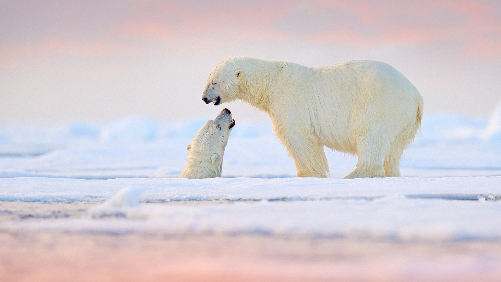
Another consequence of the high latitude is the extended summer sunlight and extended winter darkness. This has to do with the tilt of Earth—the planet’s inclination—off the perpendicular with its plane of the ecliptic, the path it takes around the Sun. That inclination is 23.5 degrees, which establishes the latitude of the Arctic and Antarctic circles (at 66.5 degrees N and S, respectively—23.5 degrees south from the poles). In summer, the North Pole leans into the Sun, resulting in the 24-hour daylight of the “Midnight Sun”; in winter, its lean away from the Sun creates the 24-hour darkness of the “Polar Night.”
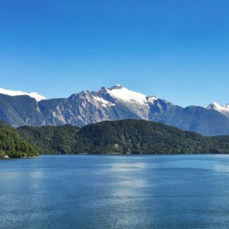
The annual net radiation—that is, the balance of incoming solar energy minus outgoing heat—declines as you proceed south to north from the subarctic to the High Arctic. It may be close to zero in places such as northern Ellesmere Island and North Greenland. The same pattern, generally speaking, is seen with average annual temperature, maximum summer temperature, and precipitation.
This aerial view of a high-latitude landmass like Ellesmere Island illustrates the fundamental climatic factors at play: the vast ice and snow cover reflecting solar energy, and the distribution of land and ocean, all of which heavily influence Arctic temperatures.
The Arctic typically experiences some eight to 10 months of extensive ice- and snowcover, with the seasonal snowmelt of spring and early summer helping set the fundamental timing of the brief growing season. Sea ice expands in winter, reaching a maximum extent in late winter/early spring, and contracts in summer, reaching a minimum in late summer/early fall. Spring and fall are but fleeting transitional seasons in the Arctic, which seesaws between the long—anywhere from six to eight months’ duration—and dark winters and the couple of months of sun-splashed summer.
Overall, the Arctic is quite a dry realm: a consequence of polar airmasses that are cold (and thus unable to hold much moisture) and generally stable (not providing the uplift necessary to induce precipitation). Much of the region receives less than 10 inches (25 cm) of annual precipitation, and parts of the “polar deserts” of the High Arctic may see a mere couple of inches (5 cm) or less in a year. There are somewhat wetter corners of the Arctic, though, such as the eastern Canadian Arctic. Taking the region as a whole, a bit more precipitation usually falls in summer, when weather-making low-pressure systems spawned in nurseries such as the Gulf of Alaska and in Baffin Bay track through, as compared with winter. Generally speaking, though, the month-by-month variation in Arctic precipitation is pretty minimal.
The southern or equatorward edge of the prevailing polar airmass in the Far North is sometimes called the Arctic front, which separates Arctic air from the westerly airstream that dominates mid-latitude weather. (An incursion of polar cold down into temperate latitudes is sometimes called an “Arctic blast” or “Arctic polar vortex.”) Roughly speaking, the position of the Arctic front in summer corresponds with the location of the ecotone, or transition zone, between the boreal forest (taiga) and Arctic tundra: the Arctic timberline (which, by the way, you can learn more about in our “Ultimate Guide to Arctic Plants”).
Another important consequence of the Arctic climate is the presence of permafrost, which describes layers of soil and rock where subfreezing temperatures prevail for two or more years and result in frozen, often ice-penetrated layers. Permafrost, which has many profound effects on the landscape and ecosystems, prevails across the Arctic and penetrates southward into the taiga in a patchy sort of fashion. The seasonal thaw of upper permafrost produces the “active layer” of soil in which plant roots and microbial life can flourish during the growing season.
Permafrost, or permanently frozen ground, is a crucial component of the Arctic climate system. Its presence, and increasingly its thaw, dictates how much heat and moisture the land can store, making it a key climatic factor in the Arctic’s delicate balance.
Climatic effects as well as interrelated aspects of soil and plantlife, plus simple geography, help distinguish the so-called Low Arctic from the High Arctic. The Low Arctic has more moisture, a longer growing season, and a deeper active layer—plus more and taller plant cover—than the colder, drier, and generally leaner High Arctic.
The fact that the Arctic Basin is a top-of-the-world body of saltwater—the Arctic Ocean—with only peripheral and scattered land area above the Arctic Circle helps explain why the northern polar region is not as cold as the southern polar region. Water has a high specific heat capacity and thus heats up and warms up more slowly than land. Its moderating influence keeps winter temperatures in the Arctic warmer than those in Antarctica, which is a huge continent with a vast interior, further isolated from maritime influence in winter by the broad fringe of Southern Ocean sea ice that forms during that season. Average elevation plays a role, too, given temperature usually decreases with altitude: Whereas much of the Arctic is by definition at sea level, Antarctica is a high-elevation continent of bedrock mantled over by a very thick ice sheet—another reason why it’s a colder place.
Specific ocean currents also exert special influence on Arctic climates. For example, the warm North Atlantic Drift (an extension of the Gulf Stream) flowing into Arctic waters prevents sea-ice formation off the coast of Fennoscandia at latitudes where winter pack ice is extensive in other parts of the Arctic.
Major Arctic (& Subarctic) Climate Zones
Among the most widely used schemes by which geographers classify global climate zones is some version of the Köppen system, based on work by climatologist Wladimir Köppen. Under the Köppen system, the terrestrial Arctic is divided between two main climate types: The Tundra Climate and the Ice Cap Climate.
Tundra Climate
The first, and definitely most extensive, is the Tundra Climate, which prevails across much of the Far North of North America and Eurasia, including most islands of the Arctic Ocean. Its southern edge, defined by areas where the average temperature of the warmest month of the year is 50 degrees F (10 degrees C), roughly corresponds with the Arctic timberline (and thus, again, that southern boundary of the Arctic front in summertime).
The Tundra Climate zone features long and very cold winters and fleeting, cool summers, with only a few months at most where temperatures average above freezing. There’s quite a lot of variation within this zone between coastal areas that are influenced by maritime airmasses, such as the Canadian Arctic Archipelago, and more interior locations, which—because they’re farther away from the tempering effect of large bodies of water—tend to experience colder winter temperatures and warmer summer temperatures.
It’s worth noting, however, that even though it’s definitely cold in the wintertime in the Tundra Climate zone, it actually doesn’t get quite as cold as the Subarctic Climate zone that lies to the south. That’s because even the more inland areas of Tundra Climate are still significantly closer to the moderating influence of the Arctic Ocean and its marginal seas than much of the Subarctic Climate zone, which includes enormous swaths of interior country in Eurasia and North America experiencing a severe continental-style climate. The coldest temperatures in the Northern Hemisphere outside of the Greenland Ice Cap (more on that in a second!) have been recorded in the subarctic depths of northeastern Siberia, where both Verkhoyansk and Oinekon have hit -90 degrees F (-67.8 degrees C).
This autumnal view showcases the Tundra Climate zone, where the lack of warmth prevents trees from flourishing, giving way to low-lying scrub, moss, and lichen. Though the colors are vibrant, remember that the average summer temperature here rarely exceeds 10∘C (50∘ F).
Ice Cap Climate (& The Coldest Arctic Temperatures)
So, about that Greenland Ice Cap: Greenland—the largest island in the world—is the only place in the Northern Hemisphere to support an ice sheet. The 660,000-square-mile (1.71-million-square-kilometer) Greenland Ice Sheet, in fact, is one of only two currently present on our planet, the other being the significantly larger Antarctic Ice Sheet at the bottom of the world. (Back in the colder, wetter days of the Pleistocene “ice ages,” ice sheets spread southward across large areas of northern North America and, to a lesser extent, northern Eurasia, and covered a lot more of the Arctic.) That massive, high-standing body of ice produces an Ice-Cap Climate, which (you guessed it) otherwise only exists in Antarctica.
Ice Cap Climates are the harshest climates on Earth, resulting from the permanent snow and ice mantle; average temperatures are below freezing in all months of the year, and are often -30 to -60 degrees F (-34 to -51 degrees C) during the winter. The coldest officially documented temperature in the Northern Hemisphere was logged by an automated weather station up on the heights of the Greenland Ice Sheet in late December 1991: -93.3 degrees F (-69.6 degrees C).
That’s an impressive record of frigidity, but it doesn’t quite hold a candle to the even deeper cold that can set in atop the larger Antarctic Ice Sheet. A weather station on the icy heights between Dome A and Dome F in East Antarctica measured -136 degrees F (-93.2 degrees C) in August of 2010, and research indicates that temperatures on the ice divide in this region likely get lower yet: perhaps -144.4 degrees F (-98 degrees C) or below!
Very little precipitation falls within the Ice Cap Climate zone given the cold, stable air, and the gravity spillage of dense air off the ice sheet can produce fierce katabatic winds along its margins.
Keep in mind that not all of Greenland lies within an Ice Cap Climate; the somewhat balmier coastal margins, more influenced by the ocean, are classified as Tundra Climate.
This mesmerizing landscape represents the Ice Cap Climate zone, where permanent snow and ice cover keep temperatures consistently below freezing. The immense, white expanse is where the Arctic records its lowest temperatures, often dipping below −50∘C (−58∘F)
The Frozen Stuff: Arctic Ice & Snow
It goes without saying that ice and snow—frozen water—are defining elements of the Arctic climate and the Arctic landscape. We’ve already noted that much of the Arctic receives pretty scanty precipitation, which means pretty scanty snowfall. But because it’s so cold, the snow that does fall tends to stick around much of the year, and where it continues to accumulate and persist across multiple years, it can densify into ice and create glaciers, icefields, ice caps (such as Bisayarfonna in Svalbard, the Penny Ice Cap in Arctic Canada’s Baffin Mountains, and Greenland’s Hans Tausen Ice Cap), and, yes, that mighty Greenland Ice Sheet.
Especially in the dry High Arctic, long-lying snowfields and snowpatches that develop in sheltered, leeward sites shielded from the sun and/or experiencing accumulations of wind-drifted snow provide critical moisture sources for vegetation during the summer. Some of these may be perennial snowfields or icepatches: not quite glaciers (which are moving bodies of ice), but still important parts of the Arctic “snowscape.”
The wide-open Northland barrens can get plenty windy, and Arctic winds do much work transporting, removing, and depositing snow. Scouring winds may keep some areas mostly bare of snow, even in winter. For example, strong winds as well as extremely dry air keep much of the northernmost extension of mainland Greenland, Peary Land, snow-free.
Arctic Ocean Sea Ice, Salinity & Temperatures
In the Arctic Ocean, and in the bordering waters of North Pacific and North Atlantic marginal seas, sea ice is a dominating phenomenon. Recall that the Arctic Basin is mainly an ocean surrounded by landmasses, unlike the case of Antarctica, which is a polar landmass bordered by an enormous reach of open water (the Southern Ocean). So Arctic sea ice, which expands during the winter southward, is more hemmed in. But whereas Antarctic sea ice can spread out unimpeded, staying comparatively thin, Arctic sea ice basically bangs and nudges together to produce a thicker, ridged pack; this, combined with the fact that the North Pole is over the ocean, means more sea ice remains in the Arctic during the summer than in the Antarctic, with older, multi-year ice prevalent.
Historically speaking, Arctic sea ice varied from a maximum of about 6 million square miles (15.5 million square kilometers) in winter to a minimum of 2.5 million square miles (6.5 million square kilometers) in summer.
The temperature as well as the salinity of the Arctic Ocean are influenced by the inflow of water from the North Atlantic and North Pacific oceans, by seasonal fluctuations of sea ice, and by freshwater inputs from major rivers draining into the basin. The annual average sea-surface temperature in the Arctic Ocean tends to hover around the freezing point of seawater—about 28.4 degrees F (-2 degrees C)—with water layers below this often a bit warmer. (Climate change is altering the temperature and other physical characteristics of Arctic Ocean seawater, mind you—see below.)
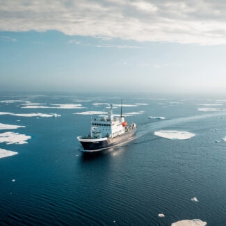
The water, in other words, is chilly—something you’ll discover all too well should you decide to brave a Polar Plunge—but the right clothing will keep you plenty comfortable from the spray on Zodiac or sea-kayaking excursions during an Arctic cruise.
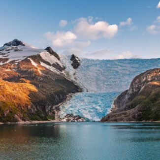
Glacial ice, the massive, millennia-old ‘frozen stuff,’ is a powerful visual reminder of the Arctic’s enduring cold. The presence and persistence of these features, from glaciers to sea ice and snow, are key to regulating global climate, highlighting the region’s intense chill.
Climate Change in the Arctic
The Arctic is among the fastest-warming parts of our planet, and thus it’s one of the epicenters of scientific research into the effects of climate change. Warming temperatures are having many impacts up here, not least in reducing the duration, extent, and thickness of sea-ice cover. Scientists are sounding the alarm about increasing “Atlantification” in the Arctic Ocean: a burgeoning influx of warmer waters from the Atlantic closer to the surface of the sea, degrading the formerly strong stratification (layering of temperature, salinity, and density) that historically helped promote sea-ice formation in the colder, fresher surface layer.
Warming sea-surface temperatures enact a vicious cycle in the Arctic Ocean. Sea ice reflects back a lot of the incoming shortwave radiation from the Sun, but with reduced sea-ice cover in the winter, more of that radiation is absorbed by the ocean, thus heating it up. This, in turn, promotes greater melt-off of sea ice during the summer, further exposing open water that can efficiently absorb solar energy amid the lavish sunlight of that season.
On land, permafrost is melting and, in places, perennial snowfields and icepatches are declining. Climate change may be allowing organisms from lower latitudes to colonize the Arctic’s terrestrial and marine ecosystems, changing the phenology (seasonal timetable) of vegetation, and impacting the seasonal movements of migratory wildlife. And all of these and other effects certainly impact the Arctic’s human inhabitants, with Native peoples such as the Inuit among the keenest observers of climate change’s real-time, unfolding impacts here.
The intense, ancient blue of this ice is a stark, visual proxy for the Arctic’s rapid warming, a phenomenon known as Arctic Amplification. This breathtaking, yet fragile beauty illustrates the profound and immediate impact of climate change on the world’s coldest region.
Weather During the Arctic Cruise Season
The Arctic is a cold place, though (as we’ve established) not the coldest place on Earth. But bear in mind cruisegoers experience this spectacular Northland in its balmiest season, summertime, when life explodes to take advantage of the abundant solar energy and retreating sea ice opens up maritime passageways to spectacular wildlands. (That said, it’s still wise to pack layers and be prepared for chilly evenings and mornings on an Arctic cruise, even in the summertime.)
Summer weather in the Arctic varies depending on your cruise location, but very generally speaking you can expect temperatures ranging between the 30s and 50s Fahrenheit (single digits to mid-teens in Celsius), with warm days in July sometimes edging into the 60s F (upper teens Celsius). The Midnight Sun is at its peak around the June/summer solstice, but extended sunlight continues into mid- and late summer, offering lots of opportunities for sightseeing and adventure each and every day.
It’s not uncommon to encounter fog in coastal areas of the Arctic during the summer, and, as we mentioned earlier, this season generally sees a bit more precipitation than in winter. But, again, most of the Arctic is a pretty dry climate, so you’re unlikely to be contending with drenching or even extended downpours on a cruise.
The severe climate of the Arctic is, of course, part of the very foundation of this special place, helping establish its basic environmental rhythms and creating a stunning dichotomy between the silent, bone-chilling dark of the Polar Night winter and the life-filled, sun-dazzled action of the Midnight Sun summer.
Even during the summer cruise season, Arctic weather remains a formidable factor. Frequent fog is common when relatively warm ocean air meets the icy sea and land, reminding travelers that despite the season, the Arctic’s cold influence is always present.

Arctic vs Antarctic Cruise: The Polar Conundrum & Comparison
Why Antarctica Is Far Colder Than the Arctic

Cape Horn: Conquering the “End of the Earth”

The Strait of Magellan: Gateway to Patagonia’s Legends
The Beagle Channel: Where Evolution Began and Borders Meet
The 10 Best Places To Visit In Chilean Patagonia
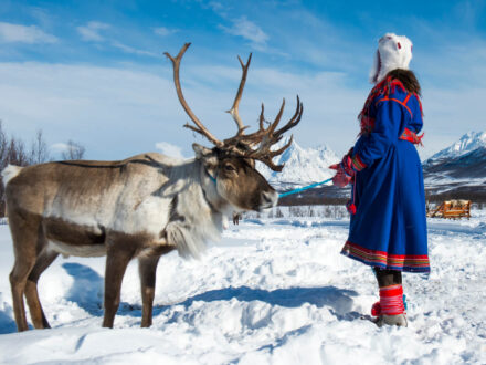
Living North: The Indigenous Peoples of the Arctic
What & Where Is The Northwest Passage? Definition & Location
Where Is The South Pole? Antarctica. But There’s 7 Of Them!
Disclaimer
Our travel guides are for informational purposes only. While we aim to provide accurate and up-to-date information, Antarctica Cruises makes no representations as to the accuracy or completeness of any information in our guides or found by following any link on this site.
Antarctica Cruises cannot and will not accept responsibility for any omissions or inaccuracies, or for any consequences arising therefrom, including any losses, injuries, or damages resulting from the display or use of this information.